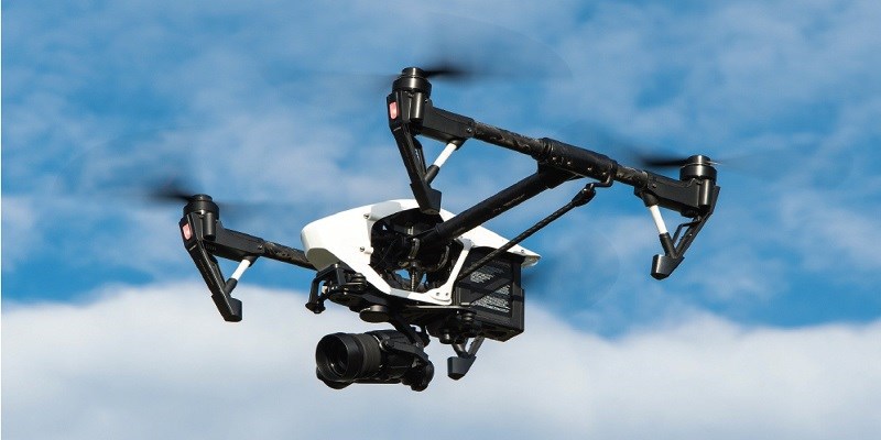
A drone, in a technological context is an unmanned aircraft. In a more formal context, drones are known as unmanned aerial vehicles (UAVs) or unmanned aircraft systems (UASs). Essentially, a drone is a flying ro-bot. The aircrafts may be remotely controlled or can fly autonomously through software-controlled flight plans in their embedded systems, working in conjunction with onboard sensors and GPS.
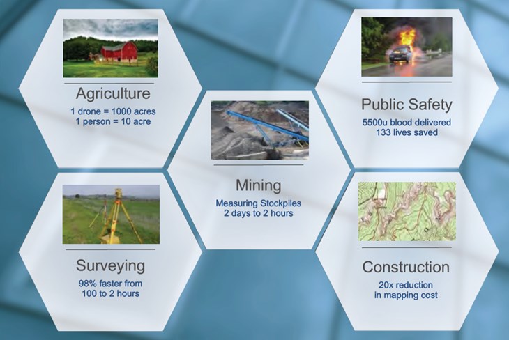
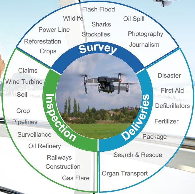
In recent past, UAVs were most often associated with the military, where they were initially used for anti-air-craft target practice, intelligence gathering and then, more controversially, as weapons platforms. Drones are also used in a wide range of civilian roles ranging from search and res-cue, surveillance, traffic monitoring, weather monitoring, firefighting, inspection of cross-country pipelines, personal and business drone-based photography, as well as videography, agriculture and even delivery services. Today’s industrial sectors have also utilized drones; having them carry leak detection and repair (LDAR) devices and sensors over and throughout plants and refineries, as well as measure emissions (i.e. UAV by remote sensing).
The San Francisco Bay Area has a 70,000-mile service area network of natural gas and electric supply. The companies service such vast land masses and complex, high traffic regions by using drones to enhance the safety and reliability of their gas network system. This is crucial, as the San Francisco Bay Area contains one of the only combined natural gas and electric utilities network, in the United States. They use to monitor electric infrastructure in hard-to-reach areas, as well as to detect methane leaks across its service area.
Exploring Carbon Capture and Storage (CCS)
Carbon capture and storage (CCS) is one of the most promising technologies for greenhouse gas (GHG) management. However, an unsolved issue of CCS is the development of appropriate long-term monitoring systems for leak detection of the stored CO2. Companies that already monitor their infrastructure for CO2 storage areas, should also use a quickly deployable, mobile measurement device, which can further increase the granularity of gas concentration measurements. An autonomous gas-sensitive micro-drone can be used to monitor GHG emissions, and more specifically, CO2. Two different measurement strategies can be used. The first is to use predefined sensing trajectories for the task of gas distribution mapping, which uses the micro drone. The second is the adaptive strategy, which uses sampling points based on an artificial potential field method. The results of real-world experiments demonstrate the feasibility of using gas-sensitive micro-drones for GHG monitoring missions. Thus, a multi-layered surveillance system for CO2 storage areas is considered.
Unmanned Aerial Monitoring
The system is capable of operating in a variety of scenarios of gas emis-sion, i.e. exhaust gas from a chimney, flue gas in case of fire, gas emission in case of an accident involving chemicals, hazardous goods, or toxic gases. Another addressed field of ap-plication is spatially resolved emission control of geodynamic active regions, waste disposals, stockpiles, industrial sites, and pollution critical areas. Due to its mobility, the system can measure gas concentration in the immediate vicinity of the object which causes the emission. A further storage of extension is to enhance the system for plume-tracking and identification of gas sources.
A monitoring system uses a unique, remotely-piloted drone with dual counter rotating propellers and carrying electric field sensing, thermal infra-red imaging, video imaging, acoustic and corona discharge sens-ing equipment. The compact, remote-ly-piloted drone can fly along a power corridor and is maintained at a fixed distance from an outer phase conduc-tor using on board electric field detection circuitry, video/infra-red imagery, and an RF/laser altimeter.
The counter rotating, twin-turbo driven configuration for the the propellers, which are mounted on coaxial vertical shafts, provide a highly stable platform, unlike conventional manned helicopters presently used for routine right of way patrols. Dual counter rotating saucer-shaped aux-iliary propellers provide a degree of stability far superior to a conventional helicopter, particularly in gusty winds. On board sensors and video cameras would permit electric utilities a more economic approach to right of way monitoring, inspection of frayed conductors or deteriorated splices through infra-red sensing. Detection of cracked insulators through acoustic/corona sensors, monitoring of critically, thermally limiting spans and other monitoring functions would also be possible.
Environmental Conditions
Volcanic activity has often affected human life both at large and at small scale. Many countries have started using unmanned air vehicles for volcanic environment applications. A flight both visual and radio-controlled mode using a multi-rotor aircraft in a hexacopter configuration. Thermal camera observations and flying tests have been done over a mud volcano, where activity proved to be related to early stage of magma accumulation within the volcano.
Tropical deforestation continues to be a major driver of biodiversity loss and greenhouse gas emissions. Remote sensing technology is increasingly used to assess changes in forest cover, species distributions and carbon stocks. However, satellite and airborne sensors can be used to cover 15 km of distance and can record videos up to 1,080-pixel resolution (high definition) and acquire aerial photographs of <10 cm pixel resolution. Aerial photographs can be stitched together to produce a re-al-time geo referenced land use/cov-er maps of surveyed areas. Further, this is used in real time mapping of local land cover, monitoring of ille-gal forest activities, and surveying of large animal species.

In today’s mining and coal steam gas industries, performing blasting includes effects and residues such as air blast, ground vibration, fly rock, toxic gases and particulate matter, aerosols, ammonia, carbon dioxide, nitrogen, nitrogen oxides and sulfur oxides. In an ideal situation, the exothermic reaction produces CO2, water vapor and molecular nitrogen, how-ever due to environmental and technical factors, other noxious gases are often produced in a range of concentrations. Uses of small unmanned ae-rial vehicles carrying air quality sensors allow precise characterization of blasting plumes in near-real time. This approach may lead to actionable data for harm avoidance or minimization. Most pollution dispersion models use predefined estimates of pollution sources and atmospheric conditions ;near-real time information from with-in the plume has been practically im-possible to collect. Flight instrument data transmitted as telemetry from the UAV provides high resolution, instantaneous micrometeorological data that can assist interpretation of concentrations detected by on-board air quality sensors. The data stream may therefore be used to feed flight path-planning algorithms or atmospheric dispersion models in near-real time.
A Canadian company in the space satellite business is currently building the first GHGSat, and will be in charge of the launch and operation once completed. This is the world’s first satellite capable of monitoring GHG and air quality gas (AQG) emissions from any industrial site in the world.
The GHGSat satellite will:
• Target a miniature spectrometer, on a nanosatellite, at individual emissions sources.
• Detect specific gases from those sources with innovative algorithms.
• Deliver unique data products to customers.
• Require no on-site equipment or presence.
Gases will be monitored with a precision in parts per million/billion, de-pending on the species with partial resolution in tens of meters. GHGSat continues to measure carbon dioxide and methane emissions from sites around the world, including oil & gas facilities, power stations, coal mines, landfills, animal feedlots, and other sources.

About the Author


